Wednesday, April 28, 2010

Today is Wednesday, So This Must Be Astoria

We decided to stay in Astoria an extra day.  Lot's to do around here and we managed to do a bit today.


Above you see a panorama shot of the Columbia River, with the Rt 101 Bridge in the background, on the left.  The weather was weird today, with rain and sun alternating and at times visible on opposite sides of the river.


These ships are docked along side the Columbia Maritime Museum - an outstanding facility and well worth the ten dollar admission fee.  Kathleen and I enjoyed it, especially all the video of the raging water at the mouth of the Columbia - and lots of stuff on the Coast Guard and their rescue craft.


Astoria was once the salmon canning capitol of the world.  The museum has a nice display of labels once used here.  Here is a shot of just a few of them:


The museum also explains the importance of the Pilots, who help guide ships across the treacherous bar and up the Columbia River.  Here's a shot of a pilot boat heading out:


If you are a fan of Lewis and Clark, you will find much to satisfy in this area of the country.  We visited Fort Clatsop, where Capt. Meriwether Lewis, William Clark and their Corps of Discovery spent the winter in 1805-06.  It was named after the local indians, the Clatsop's.


At one of the highest points in the city of Astoria is the Astoria Column.  It's 125 feet tall atop Coxcomb Hill and you can climb all the way to the top via internal spiral staircase.  There is a great view from the platform at the top.The outside of the column is covered with artwork - a form of artwork known as Sgraffito--fourteen 25-foot long scenes representing the triumphs, conflicts and turning points of the Pacific Northwest.  The picture below shows a bit more detail of a section of this artwork:


 One other thing Astoria is known for - it was the site of the filming of the 1984 classic, "The Goonies!"  We drove up to the house featured in the film.  Took a picture to share with you:


At the foot of the gravel drive leading up to the house, you will find this sign:


They actually seem to enjoy having folks come by to see the house, but don't want the car traffic.  Once you walk up the steep gravel drive to the unpaved street you will see why.  There are actually about four houses up there and there is not a lot of room to turn around.

Finally a few more shots of the river and the Rt101 bridge.  There is quite a lot of shipping on the river, including cruise boats.  A Norwegian cruise boat was docked close to our hotel.  Never did find out where it was bound when it left around 5pm.  Here are a couple of shots of the sunset and a freighter going under the bridge.  Note the rain in the background.  I took this shot from a position just in front of our room:


Well, got to hit the rack now.  Have quite a few more pictures to share, but they will have to wait.  Tomorrow we drive to Seattle.  This should take about 5 hours or so from Astoria.

HAPPY BIRTHDAY MELISSA!

Tuesday, April 27, 2010

Yachats to Astoria, Oregon

Well, we made it to the Columbia River, the border of Oregon and Washington States.  Tonight we are on the Oregon side of the river under the Route 101 bridge in a Holiday Inn Express - fairly new, nice place to stay.  The sun was shining when we got up this morning - 100% change from the night before.  We had pulled in to the Adobe Resort, right on the beach, in the rain, with 45 knot winds!  The room had windows facing out on to the Pacific and it was an awesome show.

Here is a shot of Kathleen and I out in front of the hotel, basically with the view we had from our room:


The ride up to Astoria was full of beautiful scenery and a few lighthouses.  Here are some pic's for your enjoyment:

Above is a composite photo made of three individual shots, merged together to form this panorama.  Photoshop does a great job of this.

The Yaquina Bay Lighthouse was put on line in 1871, but only served for three years.  It is the second oldest standing lighthouse structure on the Oregon coast.   It has been beautifully restored and we took the self guided tour through it today.  The volunteers are friendly and helpful and glad to explain life in a lighthouse and answer any questions.  The keeper and his wife had seven children living with them in this lighthouse when it closed.


As I have said too many times before, the scenery is beautiful and seemingly never ending as you drive up the coast.  Check out the waterfall in the shot above.

The lamp in the Cape Meares Lighthouse was first lit on or about January 1, 1890.   It's beam was visible on shop decks 15 feet above the sea and more than 21 miles away because it was projected by a first order Fresnel lens.

Below are some fun shots from yesterday - seals.  Used my 400mm lens to get these from shore:


My sincere thanks to my trusted assistant, Kathleen.  Without her, none of this would be possible.
Captain Ken

Sunday, April 25, 2010

Coos Bay, Oregon

Today is Sunday so this must be Coos Bay, Oregon.   Spent most of the day driving and stopping to see the sites in Oregon.  We left Crescent City, CA this morning and headed north on Rt 101.   The Oregon border is about 40 miles north of Crescent City.  Before we left, I took a few pictures.  Here are a couple of shots taken near the Battery Point light house, some at sunset yesterday and the rest this morning:


Also took some pic's in the Redwood Forest just south of Crescent City but did not post last night.  Better late than never and the scenery is worth the wait:


Today we drove to Coos Bay in Oregon, but made quite a few stops along the way.  Here are a few pictures:


Saw these gulls on a street lamp and just had to snap off a shot.


Surfers can be seen up and down the coast.  Got a few nice shots of this fellow.


Shot this gull over the Chetco River, Oregon.  Click on the photo to get a larger size photo.


Had a blast taking shots of the gulls.  Way too many pictures, but thought I might share a few


This was Meyers Creek Beach - a really spectacular place.


More Meyers Creek Beach--looking South


Surfers on Meyers Creek Beach


Stuff grows everywhere out here, even on the rocks!  


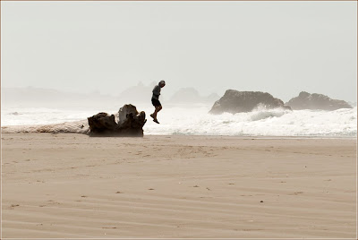
Here's a fun pic.  Kid jumping off a rock!


A Close up shot of the surfers at Meyers Creek Beach 

Tonight we had dinner with a couple who are into Geocaching.  We met them at the bar in the restaurant in Coos Bay and they invited us to join them for dinner.  Had a wonderful time talking to them.

Tomorrow we continue north on Route 101 but will only do about 80 ro 90 miles.  Our new friends suggested we stay in a small town called Yacthats and recommended a hotel named the Adobe.  It's located on the beach and a storm is forecast for tomorrow.  This place is supposed to be an ideal place to watch the storm.  It seems that people actually travel to the Oregon coast during storm season to watch the storms.  Seems the ocean puts on quite a show!
Until tomorrow, . . . . . 


Friday, April 23, 2010

Sea Ranch to Ft Bragg via California Rt 1

If you have never driven Rt 1 here in California, you owe it to yourself to do it.  The coastline is spectacular and the drive memorable - especially the 180 degree switchbacks as you go up and down the hills.  We stayed at the Sea Ranch Lodge last night and then drove to Ft Bragg today.  Stopped to view the scenery along the way.  Here are a few pic's for your enjoyment:


The coastline above was the view we had from our room at the Sea Ranch Lodge.  Sea Ranch is now a town but was originally a sheep ranch.  The owner subdivided and created the town, but everything was designed to fit into the environment.  They did a nice job and the place is beautiful.


Lots of trails, flowers, wildlife and a black beach accessible by wooden stairway are highlites of the site:


After a good morning hike around the grounds, we took to the road again.  Only got about a mile before we saw a sign indicating a bakery was about a half mile up the mountain--so off we went.  It was well worth the trip as you can see in the picture below:


With a fresh coffee and some delicious pastry in hand, the Suburban took us back to Rt 1 and on up the Coast.  The sign indicating a Point Arenas Light House looked interesting so we made the turn and two miles later found ourselves on the point.  It was great!


The museum was a good one and the walk up to the top of the Light House well worth the effort.  On  top your eyeballs are 155 feet above the ground--or so we were told.  Great views and a good guide were appreciated:


It was neat to take pictures of Pelicans from above:


Tonight we'll sleep in Ft Bragg at a lodge on a cliff overlooking the Noyo River.  


Tomorrow we continue north towards Seattle.  Don't know where we'll be tomorrow night but we have until next Thursday to get to Seattle, so we have plenty of time to enjoy the ride.  Until then, . . . .


Thursday, April 22, 2010

Sea Ranch Lodge

Kathleen and I are in a town called Sea Ranch tonight.  The drive up from San Rafael was something we will never forget.  First we headed back to the Golden Gate Bridge, because if you are that close, you just have to see it and cross it - which we did.


We also explored the parks on the north side and got some beautiful views of the city as well as the Pacific on Bonita Point.


We spent the day driving up Rt 1, The Pacific Coast Highway.  The Sea Ranch Lodge was a recommendation of Dave and Tere's and it's a very nice place, right on the coast with beautiful views of the ocean.  We had dinner and took a hike afterwards.  Here is a shot of the lodge at night looking back from the cliffs on the Pacific Ocean:


Took a bunch of pictures on Rt 1 today, but am just a bit too tired to work on them.  Will save for next time.  Not sure where we'll end up tomorrow as I won't even look at the map until breakfast.
Good night!